Number 140 of 282 by height · West Highlands
Stob Daimh
Stob Diamh
Also written Stob Diamh
3,278 ft (999 m)
Facts
- Grid reference
- NN 094 308
- Latitude, longitude
- 56.43134, -5.09133
- Area
- West Highlands
The walk up
- Distance, one way
- 4.9 mi (7.8 km)
- Climb
- 4,377 ft (1,334 m)
- Estimated time up
- 3 h 45 min
- Start
- Car park by Falls of Cruachan station
Route picked by computer, not yet checked on the hill
Summit conditions
From Sunday 1 November, 21:21. Not live.
- Weather
- Clear sky
- Temperature
- 31°F (0°C)
- Wind
- Calm
- Cloud cover
- 0%
- Rain or snow, next hour
- None
- Freezing level, rough estimate
- 3,077 ft (938 m), below the summit
- Sunrise, sunset
- 07:27, 16:39
The way up
From the car park by Falls of Cruachan station, follow the path north for 0.7 mi, climbing steeply from 190 ft to 1,050 ft. On the way you pass Loch Awe on your left. Then follow the road north-west for 0.4 mi, climbing steadily from 1,050 ft to 1,300 ft. On the way you cross the Alt Cruachan by a bridge. Then follow the path north-west for 1.4 mi, climbing steeply from 1,300 ft to 2,900 ft. On the way you pass Cruachan Reservoir on your right, go over Meall Cuanail (3,000 ft) and reach the bealach of Bealach an Lochain. It then turns north for 0.5 mi, climbing steeply from 2,900 ft to 3,450 ft. On the way you go over Ben Cruachan (3,700 ft). It then turns east for the last 1.6 mi to the summit, dropping from 3,450 ft to 3,300 ft. On the way you go over Drochard Ghlas (3,300 ft). The steepest part is between 1,750 ft and 2,600 ft, about 1.5 mi from the start. The summit is at 3,278 ft (999 m).
Written from the map, not from walking it. Paths on the ground can differ, so carry a map and compass.See it in 3D.
Getting there
By car
Car park by Falls of Cruachan station. Parking charge not known. This is where the walking route starts.
Driving directions to the Stob Daimh car park56.39357,-5.11144
By train
Nearest station: Falls of Cruachan, right by the car park.
By bus
Nearest bus stop on the map: St Conans Road junction, 2.1 mi (3.4 km) from the car park. Check the times first: many Highland buses run only a few times a day.
Public transport directionsBus and train times on Traveline Scotland
About Stob Daimh
- In Gaelic
- Stob Diamh
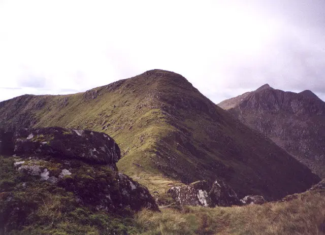
Stob Daimh is an Argyll and Bute Munro of 3,278 ft (999 m), ranked 140th of the 282. Its nearest higher neighbour, Ben Cruachan, is 1.6 miles away, and it rises 441 ft (135 m) above the col that links it to higher ground. Beinn a' Chochuill (1.5 miles) and Beinn Eunaich (2.8 miles) are the other Munros nearby. Two tops, Stob Garbh and Sron an Isean, are listed with it.
The highest visible point is a rock about 6 m north-east of the large cairn. The cairn is over 1 m high and may hide higher rock.
Tops on Stob Daimh
2 lower summits in the Munro tables, not counted as separate Munros. Keen baggers tick these too.
| Top | Height | From the summit |
|---|---|---|
| Stob GarbhNN 095 302 | 3,221 ft (982 m) | 0.4 mi (0.6 km) |
| Sron An IseanNN 099 311 | 3,171 ft (967 m) | 0.3 mi (0.5 km) |
Through the year
Hours of daylight on Stob Daimh in the middle of each month. The shorter the day, the earlier you need to start.
Stag stalking season, 1 July to 20 October. On many estates, walkers are asked to keep to set routes on stalking days: check the Scottish Outdoor Access Code site's Heading for the Scottish Hills service before you go.
Nearest Munros
| Munro | Height | Straight-line distance |
|---|---|---|
| Beinn a' Chochuill | 3,215 ft (980 m) | 1.5 mi (2.5 km) |
| Ben Cruachan | 3,698 ft (1,127 m) | 1.6 mi (2.5 km) |
| Beinn Eunaich | 3,245 ft (989 m) | 2.8 mi (4.5 km) |
Common questions about Stob Daimh
- How high is Stob Daimh?
- Stob Daimh is 3,278 ft (999 m), number 140 of the 282 Munros by height, in the West Highlands.
- How long does it take to climb Stob Daimh?
- About 3 h 45 min up and 2 h 15 min back down by our route from the car park by Falls of Cruachan station, before stops: 4.9 mi (7.8 km) each way with 4,377 ft (1,334 m) of climbing. That is one of the longer Munro days. Most people take longer than these estimates.
- Where do you park for Stob Daimh?
- Our route starts at the car park by Falls of Cruachan station.
- Can you climb Stob Daimh without a car?
- The nearest railway station is Falls of Cruachan, right by the start, and the nearest bus stop on the map is St Conans Road junction, 2.1 mi (3.4 km) from the start. Highland trains and buses are few, so check times on Traveline Scotland before you go.
- Is Stob Daimh a hard Munro?
- It involves scrambling: part of the route is graded alpine hiking on OpenStreetMap, with exposed or rocky ground where you use your hands. It is not a walk for beginners, and in winter it needs mountaineering skills.
- When is the best time to climb Stob Daimh?
- Daylight runs from about 18 hours in mid June to 7 hours in mid December, so summer gives the most time. From 1 July to 20 October it is the stag stalking season, when some estates ask walkers to keep to set routes. In winter, snow and ice turn most Munros into mountaineering terrain.
A guide only. Mountain conditions change fast: carry a map and compass and know how to use them, and read the mountain forecast for the West Highlands before you go.
Questions
Where can I get a proper mountain forecast?
Read the Mountain Weather Information Service forecast for the West Highlands, written by forecasters for walkers and climbers. In winter, also read the Scottish Avalanche Information Service report for the area.
Where does the summit weather come from?
From MET Norway's forecast model, fetched for every Munro once an hour at the summit's own height. It is computer output for one point, not a forecast written for mountains, so treat it as a guide. The past hours are what the forecast said at the time. Wind chill, the freezing level and sunrise and sunset are worked out by this site from those figures; the freezing level assumes temperature drops steadily with height, so it can be well out when cold air sits in the glens.
How was this route drawn?
It follows footpaths and tracks mapped on OpenStreetMap, from a public car park to the summit, with heights from Copernicus elevation data. A computer picked the start as the car park with the quickest mapped way up, counting the climbing as well as the distance. Nobody has checked it on the hill yet, so it may not be the usual way up, and the path may be faint or missing on the ground. A line on a map is not a description of the ground.
- About 0.8 mi of the path is graded alpine hiking (T4) in OpenStreetMap: expect scrambling or exposed ground.
- Drops 1,314 ft on the way up, so it may cross another top or a bealach first.
- Climbs to about 3,602 ft on the way, higher than this summit (3,278 ft), so it crosses a bigger hill first.
- Goes over Ben Cruachan on the way.
- Path geometry: © OpenStreetMap contributors (ODbL), Overpass API extract fetched 2026-10-24T19:56:08.831Z. Start chosen automatically: the public car park on a public road with the shortest mapped-path route to the summit (busy roads and T4 paths weighted against).
- Elevation: Copernicus DEM GLO-30 (© DLR e.V. 2010-2014 and © Airbus Defence and Space GmbH 2014-2018, provided under COPERNICUS by the European Union and ESA), sampled every 50 m, 3-sample median, 5 m hysteresis on ascent.
- Summit position: Database of British and Irish Hills v18 (CC BY 4.0).
Built 2026-10-25.
How is the time up worked out?
With Naismith's rule, the standard hill-walking estimate: an hour for every 3.1 miles (5 km), plus an hour for every 1,969 ft (600 m) of climbing, with no stops. For this route that gives about 3 h 45 min, one way. It ignores rough ground, weather, stops and the walk back down, so most people take longer.
Where do the car parks and bus stops come from?
From OpenStreetMap. Distances are straight lines, not the way you would walk or drive. A bus stop on the map says nothing about how often a bus calls: many Highland buses run a few times a day, some only on school days or by booking, so check Traveline Scotland first. The map cannot tell whether a car park is on a public road, so a remote one may only be reachable on foot or by train.
Where do the Gaelic names and stories come from?
From the hill's article on English Wikipedia and its Wikidata entry, put into a few words of our own. Meanings and pronunciations are only given where the article states them; many Gaelic hill names are old and their meaning is uncertain.
Where do the height and grid reference come from?
From the Database of British and Irish Hills, the surveyed list most baggers use. Stob Daimh is hill 244 there.
Sources: Database of British and Irish Hills (CC BY 4.0), OpenStreetMap (ODbL), MET Norway (CC BY 4.0), Wikipedia (CC BY-SA 4.0) and Wikidata, Copernicus elevation data, Sentinel-2 cloudless imagery by EOX. All credits and licences.